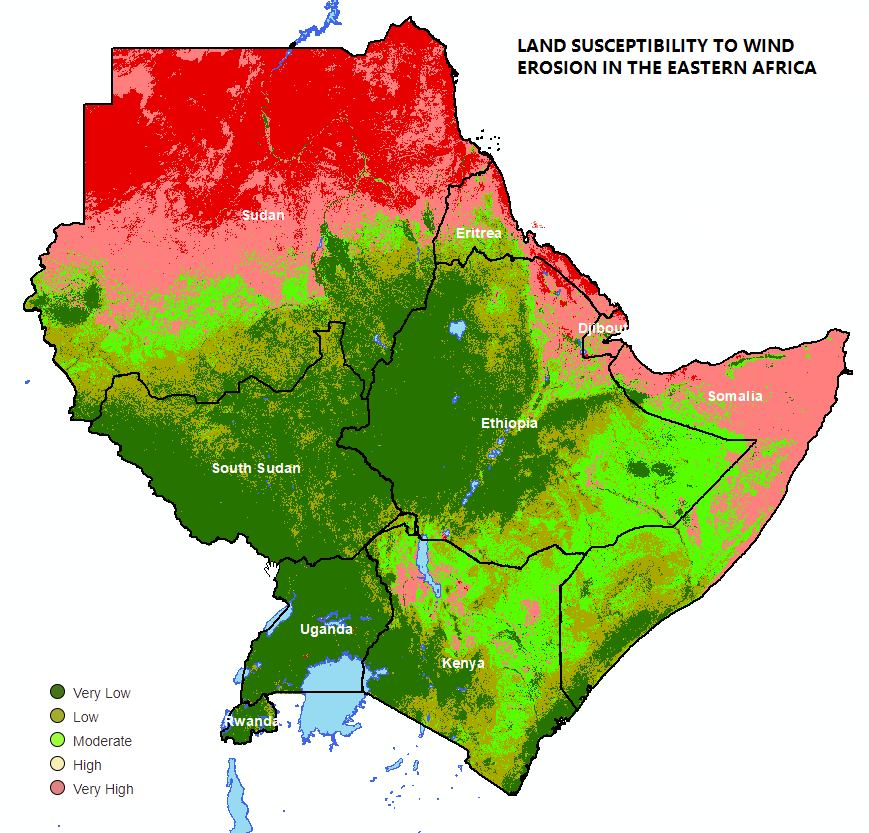
Land Susceptibility to Wind Erosion (LaSWE)
The Regional Centre for Mapping of Resource for Development (RCMRD), under the Global Monitoring for Environment and Security & Africa (GMES & Africa) project, with patnership with LocateIT Limited Company, implemented Earth Observation based System for Land Susceptibility to Wind Erosion (LaSWE). The application’s main aim was to use Earth Observation methods/algorithms and tools to generate geospatial data products for Wind Erosion Modelling.
The overall LaSWE goal aligns with GMES & Africa thematic chapters identified and agreed on as the Action Plan, which includes:
Long term Management of Natural Resources;
Water Resource Management;
Marine & Coastal Areas Management;
Food Security and Rural Development;
Climate Variability and Change;
Disaster Risk Reduction;
Health;
Conflict and Political Crisis, and
Infrastructure and Territorial Development.
Thus, LaSWE implementation ensures an evidenced based information, supports the end users and stakeholders towards monitoring and assessing wind erosion impacts in the Eastern Africa Region, in order to achieve sustainable enviromental management.
Preamble
LaSWE Factor Modelling
- Background to Land Susceptibility to Wind Erosion Modelling
- Modelling Climate Erosivity Factor (CE) in LaSWE
- Modelling Erodible Fraction Factor (EF) in LaSWE
- Modelling Soil Crust Factor - (SC) in LaSWE
- Modelling Fractional Vegetation Cover Factor (FC)
- Soil Roughness Factor (SR)
- Modelling Land Susceptibility to Wind Erosion Sensitivity (LaSWE)
Data Upload and Maintenance
- Django Admin Site Administration Guide
- Updating Climate Erosivity Regional Output
- Updating Erodible Fraction Factor
- Updating Soil Crust (SC) Factor
- Updating Surface Roughness (SR) Factor
- Updating Vegetation Cover Sensitivity (VC) Factor
- Updating the Index of Land Susceptibility to Wind Erosion (ILSWE) Output